The Five Islands That Carry the Weight of Global Marine Records
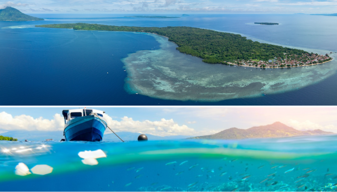
Bunaken National Park sits inside the Coral Triangle, the recognized epicenter of marine biodiversity on Earth, positioned off the northern coast of Sulawesi in Manado Bay. The park encompasses five islands: Bunaken, Siladen, Manado Tua, Mantehage, and Nain, covering a total area of 890 square kilometers, of which 97 percent is open water. Established in 1991 as one of Indonesia's first marine protected areas, Bunaken National Park carries a marine species catalog that exceeds most comparable protected zones anywhere in the Indo-Pacific.
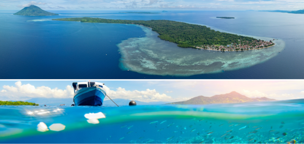
Over 390 species of coral have been recorded within the park boundaries, alongside an estimated 2,000 species of fish, populations of dugongs, green sea turtles, dolphins, reef sharks, and occasional visits from sperm whales and pilot whales.
The terrestrial component of the park, meaning the five islands themselves, is functionally inseparable from the underwater system it protects. Each island generates its own ecological influence on the surrounding reef through freshwater drainage, sediment load, mangrove filtration, and the current deflection patterns created by their physical mass in the Sulawesi Sea.
The park's location near the center of the Coral Triangle places it within a convergence zone where the biodiversity output of three ocean systems overlaps into a single compressed marine environment: the Pacific, the Indian Ocean, and the internal Indonesian Sea. Seven times more coral genera exist here than in Hawaii. Over 70 percent of all fish species known to Indonesian waters have been documented within the park.
Volcanic Geology and the Upwelling That Feeds the Reef Walls
North Sulawesi is a geologically young landmass, between five and twenty-four million years old, shaped by explosive volcanism occurring between 1.5 and 5 million years ago. Manado Tua, rising over 600 meters above sea level as a dormant volcanic cone, is the most visible expression of this eruptive history above the waterline. Below the surface, the volcanic geomorphology of the park produces the vertical wall formations that define Bunaken's underwater identity.
These walls begin as shallow as five meters below the surface and drop continuously to depths exceeding 1,800 meters between Bunaken Island and the Manado mainland, a descent that places the deepest zones well outside recreational diving limits.
The staggering depths created by this volcanic subsidence drive the nutrient mechanism that makes Bunaken's reefs so dense. Deep water rising toward the surface, a process called upwelling, carries cold, mineral-loaded water from the ocean floor into the reef zone. The combination of lunar-driven currents with the shape and positioning of the five islands creates plankton-rich upwellings that become trapped between the landmasses, concentrating food sources that sustain every level of the reef food chain.
Oceanic currents sweeping into Bunaken deliver a continuous supply of nutrients that feeds enormous schools of black triggerfish, barracuda, moray eels, and sea snakes alongside the corals themselves. This constant nutrient delivery system is why Bunaken's reef walls carry dense coral coverage from the shallowest surface zones down to depths where light barely penetrates.
Sea Sasi and the Ma'nene Influence on North Sulawesi's Coastal Culture
The communities living within and around Bunaken National Park maintain a customary resource management tradition rooted in the Sasi system, an adat-based framework that designates specific marine areas and species as protected under customary law for defined periods.
Sea Sasi functions as a locally enforced conservation mechanism, restricting harvesting of particular reef species, sea cucumbers, and other resources until communal ceremonies authorize the seasonal opening of the protected zone.
The Sasi system predates the formal establishment of the national park by generations and operates through community authority structures that run parallel to the official park management framework administered through Manado.
The Ma'nene tradition, originating specifically from the Talaud Islands north of the Bunaken region, carries cultural weight throughout the broader North Sulawesi coastal community. As a ritual of ancestral reverence involving the ceremonial care of preserved remains, Ma'nene reinforces the worldview common across the Sangihe-Talaud ethnic community that the living and the ancestral past occupy a continuous relationship.
This relationship extends to the sea, where ancestral claims to fishing grounds and reef territories are recognized through customary ceremony rather than formal land registry.
The communities whose villages border Bunaken National Park carry this cultural framework into their daily relationship with the reef, treating specific zones as ancestrally governed spaces that coexist with the national park boundary.
Kabasaran Dance and Bamboo Music at the Water's Edge
The Kabasaran is a traditional war dance originating from the Minahasa community of North Sulawesi, performed exclusively by male dancers who carry inherited weapons including swords, spears, and shields. The dance derives its name from the word kawasalan, meaning to dance like a rooster fighting, and the word evolved through Manado Malay into kabasaran while retaining the same meaning.
Dancers wear red costumes and move with fierce, rapid footwork accompanied by percussion instruments including gongs, drums, and the kolintang, a xylophone-type instrument made from wooden keys specific to Minahasa musical tradition.
When maritime festivals open along the Bunaken coastline or when distinguished guests arrive at the islands, the Kabasaran appears as the primary welcoming performance. Its sacred nature historically restricted participation to descendants of established kabasaran dancer lineages, with weapons passed through family lines as both performance tools and ancestral inheritance.
Bamboo music ensembles, using pitched bamboo tubes struck in coordinated rhythmic patterns, accompany coastal ceremonies where the Kabasaran is not performed, providing a distinct sonic identity to community events tied to the sea.
Together these art forms function as the cultural architecture of the fishing and diving communities whose presence predates the park's formal designation.
Tulude: The Annual Coastal Thanksgiving of the Sangihe-Talaud Community
The Tulude ceremony is the annual thanksgiving ritual of the Sangihe-Talaud ethnic community, practiced each year at the end of January across the islands of Sangihe, Talaud, and Sitaro at the northern tip of North Sulawesi. The term Tulude derives from the word suhude, meaning to push or to reject, referencing the ceremonial act of pushing away the old year and welcoming the new one.
Before outside religions arrived in the region, the ceremony opened with the launching of a small boat loaded with jewelry and offerings into the open sea, a physical act of relinquishing the past year's difficulties to the water.
In its contemporary form, Tulude carries deep religious significance as an expression of gratitude to Mawu Ruata Ghenggona Langi, the supreme deity recognized in the traditional Sangihe-Talaud cosmology. The ceremony involves communal gatherings, traditional food preparation, performance of customary arts, and formal acknowledgment of the blessings of the previous year alongside petitions for protection in the year ahead.
For the Sangihe-Talaud families who have settled across the islands within and adjacent to Bunaken National Park, Tulude functions as the calendar anchor of community identity, connecting island-based fishing households to their archipelagic origins north of the park's boundaries.
West Siladen Coral Wall: The Pygmy Wall Where Tiny Life Dominates
The western wall of Siladen Island presents a dive profile distinct from the dramatic deep-drop scenarios that define Bunaken's main sites. The wall descends to approximately 35 meters before transitioning, with coral growth rated consistently excellent from the surface reef top through the full depth range. The site carries a particularly high density of macro life concentrated within the wall's crevices, overhangs, and coral formations.
Pygmy seahorses, among the smallest vertebrates observable by recreational divers, anchor themselves to sea fans along this wall in concentrations that surpassing most other sites within the park. Halimeda ghost pipefish, squat lobsters, nudibranch species, and flatworms populate the same zone in numbers that make the western Siladen wall a dedicated macro photography destination.
The currents along this section of Siladen run gentle enough for controlled hovering, which is operationally critical for the patience that pygmy seahorse photography requires. The shallow reef top extending along the entire western side of the island adds a snorkeling dimension to a site that serves advanced underwater photographers equally well.
Schools of long-jawed mackerel and fusiliers move through the water column above the wall, and resident sea turtle populations use the reef top as a resting and feeding zone.
The contrast between the minute life embedded in the wall surface and the larger pelagic species passing above it compresses two entirely different diving experiences into a single site.
Muka Kampung at Manado Tua: Where Competing Currents Collide
The dive sites on the eastern face of Manado Tua island, grouped under the broader Muka Kampung designation, occupy a position in the park's current geography that produces conditions absent elsewhere in Bunaken. Manado Tua's volcanic mass generates significant current deflection as water flows around the island, and the eastern face receives the collision zone where opposing current streams meet.
This convergence produces the consistent presence of pelagic species that require current-rich environments for feeding efficiency.
White-tip reef sharks, eagle rays, and large tuna species use this current meeting point as a hunting corridor, appearing with regularity that makes Muka Kampung a reliable large-animal site rather than a chance encounter location.
The wall profile here drops rapidly below recreational depth limits, and the topography includes overhangs and deep cracks filled with enormous barrel sponges and gorgonian sea fans reaching widths that make them among the largest documented within the park.
Visibility at this site frequently exceeds thirty meters, placing it among the highest-clarity positions in Bunaken National Park.
The strong and unpredictable nature of the currents restricts this site to experienced divers who can read current shifts and use reef hooks effectively. The contrast with the calm conditions at most Bunaken main sites is immediate and physically pronounced from the moment of entry.
Mantehage Island's Mangrove Forest: The Green Labyrinth Above the Reef
Mantehage Island sits at the northern edge of Bunaken National Park, farther from the main dive resort infrastructure on Bunaken and Siladen, which results in significantly lower visitor traffic relative to its ecological significance.
The island is fringed by 1,453 hectares of mangrove forest, the largest mangrove coverage within the park system, creating a green labyrinth of aerial root networks, tidal channels, and brackish water zones that function as the primary nursery habitat for juvenile reef fish species throughout the broader park ecosystem.
The mangrove root systems trap sediment, filter terrestrial runoff, and create sheltered micro-environments where species that require protected early-life conditions develop before moving into the open reef as adults.
Dugongs, which are increasingly rare across Indonesian waters, use the seagrass meadows adjacent to the Mantehage mangroves as feeding grounds, making the island one of the most reliable dugong observation positions within Manusela National Park system.
The dive sites off Mantehage's western and southern faces expose shallow reef flats that emerge at low tide, with barracuda schools, giant trevally, and schooling tuna hunting along the reef edge where the flat meets open water.
Because of its remoteness, the Mantehage reef carries a condition quality that is measurably more pristine than the higher-traffic sites closer to the Bunaken resort cluster.
Tanjung Parigi: The Pinnacle Zone at Bunaken Island's Northern Bay
Tanjung Parigi, a site named after the small village sitting at the northern bay of Bunaken Island, delivers a site architecture that moves through three distinct underwater zones within a single dive profile. Entry begins over a large sandy slope at shallow depth, descending from five to approximately twenty meters, where critters including jawfish, scorpionfish, and squat lobsters occupy the sandy substrate between coral patches.
The slope transitions into a large pinnacle structure rising from the sand, consistently hosting ghost pipefish and leaf scorpionfish in its overhangs and shadow zones, before dropping into a vertical wall that carries the coral density and structural complexity characteristic of Bunaken's most celebrated reef sections.
The currents on this northern bay exposure run mild to moderate, and the visibility frequently reaches the upper range documented across the park. The shallow reef top above the wall system carries pristine hard coral gardens with a structural integrity that indicates minimal anchor damage and consistent protection from the customary access management maintained by the Bunaken community.
Large unicorn fish and schools of needlefish populate the surface zone above the reef top, while deeper on the wall the full complement of Bunaken macro life occupies every available surface.
The site's bay position on the northern face of Bunaken Island provides natural shelter from the open-ocean swells that affect the exposed outer island faces, making Tanjung Parigi accessible across a wider range of weather conditions than the current-heavy sites on Manado Tua's northern and eastern exposures.
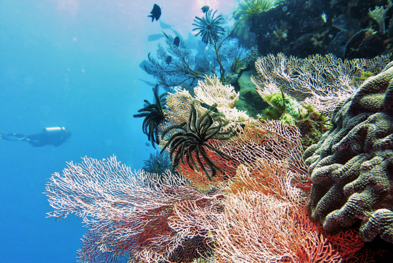
Practical Access and Dive Infrastructure for Bunaken National Park
The entry point for Bunaken National Park is Manado, the capital of North Sulawesi Province, reachable by direct flights from Jakarta, Makassar, and several other Indonesian hubs, with connections available from Singapore and other regional airports.
From Manado, boat transfers to Bunaken Island take approximately thirty to forty minutes, with faster vessels reducing this to under thirty minutes from the Manado waterfront departure points. Siladen Island sits northeast of Bunaken and is reachable in a comparable transfer time.
National park entry fees are collected at the point of boat departure and support both the park administration and a community fund benefiting the island villages. Dive operations are concentrated on Bunaken, and Siladen islands, with resort-based dive centers providing equipment rental, guided dive packages, and instruction across skill levels.
The park records 22 official dive sites distributed across the five islands, with water temperatures ranging from 26 to 30 degrees Celsius and visibility commonly reaching 20 to 35 meters.
The deepest documented point between Bunaken and the mainland drops to approximately 1,800 meters, which makes the park a technical diving frontier that Bunaken Oasis Explorers is currently mapping beyond recreational depth limits for the first time.
Year-round diving conditions apply, though some sites with strong current exposure are best approached during specific tidal windows that experienced local guides calibrate before each day's dive schedule.