
Semarang City stands as Indonesia's fifth-largest city and the capital of Central Java province, occupying a position on the north coast of Java that has made it a convergence point for maritime trade, ethnic settlement, and cultural exchange for over six centuries. The city's layered identity of Javanese, Chinese, Arab, Dutch, and Indian influences compressed into a single urban fabric, produces an urban character that no other city on Java fully replicates.
Semarang City was named the cleanest tourist destination in Southeast Asia by the ASEAN Clean Tourist City Standard for 2020 to 2022, a recognition that reflects not just physical maintenance but the organizational depth of a city that takes its public environment seriously.
The city sits on a topography that divides naturally between the flat, low-lying northern coastal zone and the hilly southern terrain that rises progressively toward the Ungaran highlands. That geographic split is not merely scenic it has directly shaped how different ethnic groups settled, how commercial activity organized itself, how flooding risk distributes across neighborhoods, and how tourism and residential development stratified across elevation bands.
Understanding Semarang City requires reading both its flat coastal history and its elevated residential and educational landscape simultaneously.
Regional Division and Destination Characteristics Across Semarang
Semarang City is divided into 16 districts, each with a distinct functional character that shapes the visitor and resident experience in different ways. The broadest useful division for understanding the city's geography for purposes of navigation, tourism, and logistics runs along the axis of north-south and the clusters of central, south, west, and east. Each geographic cluster carries its own dominant land use, demographic character, and set of attractions that do not overlap cleanly with neighboring zones.
For visitors approaching Semarang City for the first time, the city's topographic split between the flat coastal lowlands and the elevated southern terrain is the single most important spatial concept to internalize. Routes, weather, flood risk, accommodation quality, and access to specific attractions all correlate directly with whether one is operating in the lower northern zone or the higher southern and western terrain.
Central and North Semarang: Center of History and Acculturation
The historic heart of Semarang City is concentrated in the central and northern zones, where the city's successive waves of ethnic settlement left their most visible architectural evidence. The Old City locally known as Kota Lama preserves the Dutch colonial grid of late 17th and early 18th century commercial and administrative buildings in a state that makes it one of the most intact VOC-era urban districts in Indonesia.
The Blenduk Church, a Protestant church built in 1753 with its distinctive copper dome, anchors the northern edge of this heritage zone. In early 1708, Semarang officially became the seat of the VOC government, and the physical infrastructure of that administrative transition is still visible in the grid of Kota Lama today.
The Pecinan — Semarang's Chinatown — occupies the zone between Kota Lama and the city's commercial center, functioning simultaneously as a residential area, economic cluster, religious hub, and cultural territory. The Tay Kak Sie Temple, one of the oldest and most active Chinese temples in Semarang City, sits within this district as a functioning place of worship rather than a preserved monument.
The acculturation between Chinese and Javanese culture in this part of the city is expressed architecturally, linguistically, and culinarily in ways that generations of intermarriage and commercial interaction have layered onto each other since the 15th century.
Klonengan and Kauman — the Arab quarter — add an Islamic commercial and religious layer to the acculturation geography of central Semarang City. The Grand Mosque of Central Java, one of the largest mosques in Indonesia, sits as the most visible contemporary expression of the city's Islamic identity, even as its architectural vocabulary deliberately incorporates Chinese-influenced umbrella roofline elements that mark it as a product of Semarang's specific acculturative history rather than a generic regional mosque typology.
The northern coastal zone carries a different set of challenges. Rob the tidal flooding that regularly inundates the lowest-elevation streets of North Semarang has been a persistent problem for residents and logistics operators in this part of the city for decades.
The phenomenon is a product of land subsidence combined with sea-level dynamics, and it affects access routes, property values, and daily mobility patterns in the northern districts in ways that visitors planning routes to coastal or port-area destinations need to account for practically.
South Semarang and Gajahmungkur: Upscale and Exclusive Area
The southern hillside zone of Semarang City, anchored by the Gajahmungkur district, carries the highest concentration of upscale residential properties, embassies, consulates, established hotels, and exclusive dining establishments. The elevation advantage of this zone — sitting above the coastal lowlands by a significant gradient provides cooler air, lower flood risk, and panoramic views over the city and toward the Java Sea on clear days.
The Candi Baru area within Gajahmungkur is the most densely developed upscale accommodation cluster in Semarang City. Properties along the Jalan Rinjani corridor and the broader Candi Baru street network offer a combination of proximity to the city's commercial center and the residential quiet that elevation provides.

The Bukit Sari area extends this upscale residential-and-accommodation zone further into the hillside terrain, where villa-style properties with terrace views over the city's lower districts represent the premium end of Semarang City's accommodation market.
For visitors prioritizing views over urban convenience, the hillside accommodation along Candi Baru provides what no property in the flat northern zone can deliver: the capacity to look down over the entire city toward the port and the Java Sea from a bedroom window.
That visual relationship between elevation and cityscape is one of Semarang City's most underutilized tourism assets among visitors who default to central-area hotels without considering what the hillside offers.
West Semarang and Gunungpati: Nature and Education
The western and southwestern zones of Semarang City incorporate a substantially different landscape from the dense urban core. Gunungpati district occupies a hilly, partially forested terrain that contains the main campus of Universitas Negeri Semarang one of the largest state universities in Central Java alongside a patchwork of agricultural land, residential villages, and natural areas that give this part of the city a character closer to a highland university town than an urban district.
Goa Kreo, located in the Gunungpati area near Jatibarang Reservoir, is one of Semarang City's most distinctive natural tourism destinations. A cave complex inhabited by a population of long-tailed macaques, Goa Kreo sits above the Jatibarang Reservoir in a green valley that requires a descent from the road into the riverine terrain.
The site combines heritage significance local tradition connects the cave to a resting point used during Sunan Kalijaga's search for teak wood for the Demak Great Mosque with active wildlife encounter and scenic reservoir views that stand in sharp contrast to the urban character of most of the city. Visitors reaching Goa Kreo approach it most directly via Jalan Semarang-Boja before turning toward the reservoir access road.
The western zone also serves as a logistics corridor for traffic moving between Semarang City and the Kendal-Batang-Pekalongan coastal axis to the west, connecting the city to the Trans-Java toll road network at the western interchange. For freight logistics, this western approach distributes heavy vehicle traffic away from the congested city-center road network.
East Semarang and Gayamsari: Magnificent Religious Center
The eastern zone of Semarang City anchored by Gayamsari district is most significantly defined by the presence of the Grand Mosque of Central Java — Masjid Agung Jawa Tengah — which sits within this area as the single most prominent religious structure in the province.
The mosque's scale is substantial: the main prayer hall accommodates thousands of worshippers, and the outer plaza with its retractable umbrella canopies borrowed architecturally from the Masjid Nabawi in Medina provides covered outdoor space for the overflow congregation during major prayer events.
The architectural vocabulary of the Grand Mosque of Central Java reflects Semarang City's acculturative identity directly. The building combines Arabic-Islamic structural forms with Javanese roofing elements and Chinese-influenced decorative details, producing a religious building that is simultaneously orthodox in its worship function and syncretic in its visual language.
The mosque complex also includes a museum of Islamic development in Central Java, a tower with observation deck, and a library, making it a cultural and educational destination within its religious function.
East Semarang and the Gayamsari district also carry the primary commercial and industrial logistics character of the city's eastern fringe, connecting toward the Demak corridor and the Trans-Java axis that runs northeast toward Kudus, Pati, and eventually Surabaya.
Culture and Ethnicity: The Harmony of Acculturation in Semarang
The ethnic composition of Semarang City has produced a cultural product unlike anything elsewhere in Java. The dominant Javanese population coexists with one of the largest ethnic Chinese communities in Indonesia — a presence that has been continuous since at least the 15th century when Admiral Zheng He's fleet visited the area, leaving the foundation for what would become the Sam Poo Kong Temple complex in the Simongan district
Arab merchant communities contributed the Islamic commercial and intellectual layer, while Dutch colonial administration added the architectural and institutional infrastructure of Kota Lama.
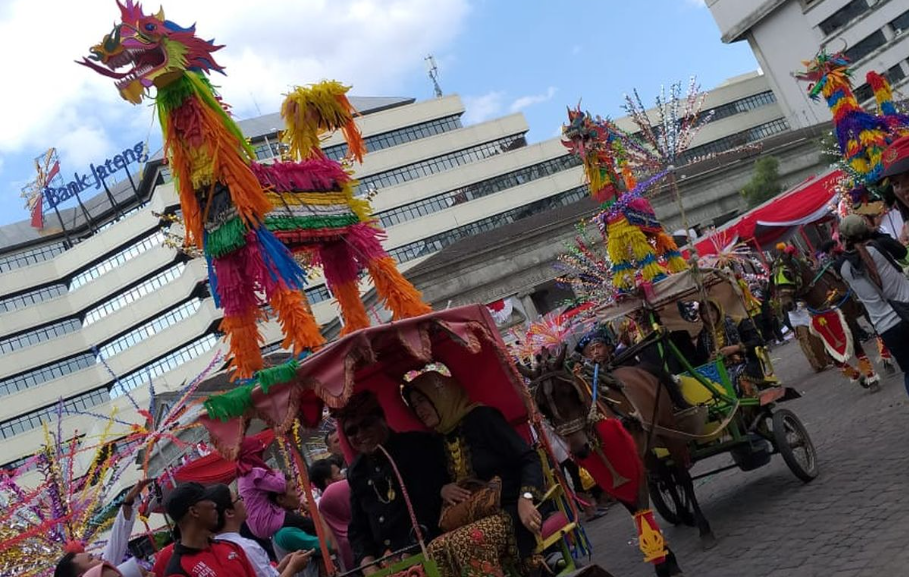
The Warak Ngendhog a mythical creature paraded during Dugderan, Semarang City's pre-Ramadan festival is the single most precise cultural symbol of how this acculturation operates in practice.
The creature's composite body combines a Chinese dragon head, an Arabian camel torso, and Javanese goat legs into a single figure that no individual ethnic tradition would produce independently. It is a community invention that belongs specifically to Semarang City's multicultural history, and it appears nowhere else in the same form.
The local dialect spoken in Semarang City carries its own acculturative fingerprint. The Semarangan dialect of Javanese carries phonetic and vocabulary influences from Hokkien Chinese contact language, producing a speech pattern that sounds distinctly different from the Yogyakarta or Solo Javanese standards.
Residents of the Pecinan area in particular speak a Javanese register that non-Semarang Javanese speakers identify immediately as locally specific.
Alternative Routes and Travel Logistics in Semarang City
Navigating Semarang City by road requires awareness of two recurring traffic conditions that affect specific corridors in predictable ways. The first is the Gombel hill — Tanjakan Gombel — located in the Banyumanik district on the south axis connecting the city center to the Ungaran toll road interchange.
This steep gradient section on the Jatingaleh-Banyumanik corridor handles the primary south-bound traffic volume toward Solo, Yogyakarta, and Ambarawa, and it is a point where heavy vehicle incidents create extended closures and where congestion builds rapidly during peak periods, holidays, and the mudik exodus seasons.
The alternative for vehicles needing to reach the southern residential zones, the university area, or the Banyumanik interchange without using the Gombel gradient runs through the Jangli-Undip corridor or the Sampangan route. The Jangli route approaches the Banyumanik zone from the east through the Tembalang corridor, bypassing the Gombel slope entirely and distributing the vehicle load through a different gradient profile.
The Sampangan route provides a western approach to the same southern zone, useful for vehicles originating from the Gajahmungkur and West Semarang areas.
The second persistent route condition is the rob flooding in North Semarang, which regularly makes specific streets in the coastal lowlands impassable during high tidal events. Visitors or logistics operators routing through the northern port area, the Terboyo terminal zone, or the coastal warehouse districts need to verify road conditions before committing to routes that pass through the lowest-elevation streets of the northern districts, particularly during the northwest monsoon period from November to February.
For visitors accessing Sam Poo Kong Temple from the city center, the most direct route runs west from Simpang Lima through Jalan Pahlawan and then south-southwest to the Simongan area a journey of approximately 15 to 20 minutes by private vehicle under normal conditions.
Goa Kreo requires a longer west-and-south approach through the Gunungpati road network before descending to the Jatibarang Reservoir access point, with total journey time from the city center of approximately 40 minutes.
Brown Canyon: Semarang's Hidden Geological Attraction
Brown Canyon is one of the most visually striking hidden attractions in Semarang City a former sand and gravel mining site in Rowosari village, Tembalang district, whose decades of extraction have sculpted the hillside into a landscape of exposed sandy-brown cliffs, deep cuts, and terraced geological formations that draw immediate comparisons to the American Southwest.
The site was not designed as a tourist destination. It emerged organically from a working quarry operation, and that industrial origin is still visible in the active mining trucks that continue operating through sections of the site.
Entry to Brown Canyon carries no official admission charge, though informal contributions to the local community are customary. The best visiting conditions occur in the late afternoon when active heavy vehicle operations reduce and the low-angle sunlight illuminates the amber cliff faces most dramatically.
The site is located approximately 8 kilometers from the Semarang City center via Jalan Setiabudi toward Tembalang, with the total drive taking between 30 and 45 minutes depending on traffic conditions in the Tembalang corridor.
For visitors with photography as a primary purpose, Brown Canyon delivers a visual environment that no other site within Semarang City's boundaries offers — the combination of scale, color, geological texture, and the contrast between the sandy canyon walls and the green vegetation growing along the upper ridges produces compositions that are genuinely uncommon within a major urban area.
Paragliding and Best View Spots Above Semarang City
The most accessible paragliding activity in Semarang City's operational catchment area centers on Gunung Gajah, a hill within the city's southern elevated terrain that offers tandem paragliding operations with views over the urban expanse toward the Java Sea. Operating hours run from approximately 08.00 to 17.00, with tandem packages covering a 20-minute flight duration for participants between 20 and 100 kilograms.
The aerial perspective from the paragliding altitude above Semarang City's southern hills is one of the few ways to comprehend the full spatial scale of the city — the flat northern lowlands, the port infrastructure, the Java Sea horizon, and the rising highland terrain to the south all become simultaneously visible in a way that no ground-based viewpoint replicates.
For visitors who prefer static elevated viewpoints over active aerial sports, the Candi Baru and Bukit Sari hillside areas provide the most consistent and accessible panoramic views over Semarang City. Properties in this zone positioned on the hillside facing north deliver unobstructed sight lines over the city's rooftop layer toward the Java Sea.
Several café and restaurant establishments on the Candi Baru slope have built their primary commercial proposition around this view, offering the panorama as a complementary asset to food and beverage service in the evening when the city's lights replace the daytime skyline.